Pingtang National Geopark across Pingtang County, is adjacent to Dushan County in the east and Guangxi Nandan County in the south, is connected to Huishui and Luodian counties in the west and borders with Guiding County and Duyun City in the north. It is a connecting part of Guangxi Jiuwan Dashan and Weinan Mountainous Areas.
Pingtang National Geopark includes “Yushui Jinpeng(玉水金盆)” Scenic Spot, Liuyi Scenic Spot, Longtang Lake Scenic Spot, Zhangbu Scenic Spot, Jiacha Scenic Spot, Anjing Scenic Spot and Dawotun Scenic Spot, with a total area of about 350 square kilometers.The soluble carbonate rocks are widely distributed, and the karst landforms account for 80% of the total area of the whole area. There are mainly four types of topography, peak forest basin, peak forest depression,peak cluster depression and peak cluster funnel that form a number of valuable geological landscapes.
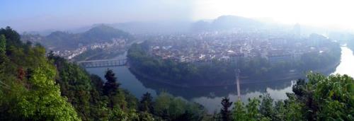
There are various types of landforms in the region. The cone peaks are sharp and dense. The canyons are deep and steep. Rivers often appear in the volcanic flow or through the canyons, and they are irregularly curved between different rock layers to form a strange phenomenon between light and dark. There are various types of landforms in the region. The cone peaks are sharp and dense. The canyons are deep and steep. Rivers often appear in the volcanic flow or through the canyons, and they are irregularly curved between different rock layers to form a strange phenomenon between light and dark. In the layered karst landforms, it is covered with many well-preserved original ecological forests, shows a variety of natural landscapes. With its rich species and peculiar hydrological effects, the area has become a treasure trove of scientific research and a tourist attraction.